Leave at 8:30: Toronto waterfront trails parents can finish by noon
Leave at 8:30: Toronto waterfront trails parents can finish by noon
For a family stroll with a stroller, take the Martin Goodman Trail through Humber Bay Park. For a longer ride, do the full Martin Goodman end to end. For paddling or a beach day, catch the ferry to the Toronto Islands. For birding and open sky, walk Tommy Thompson Park. For a dramatic view with a real workout, drive to the Scarborough Bluffs. Maps for all of them are free from the Waterfront Trail and the City of Toronto.
TL;DR:
- Parking and crowd levels are key considerations; arrive before 10:00 AM to secure parking and avoid busy weekends on popular trails.
- The Martin Goodman Trail is fully paved and stroller-friendly, but surface quality varies significantly between zones, especially near Scarborough Bluffs.
- Ferry schedules for the Toronto Islands can be unpredictable on warm weekends, so online ticket purchase and early departure are recommended.
- The trail system’s length is about 22 km from Humber Bay to the Beaches, but most families won’t walk or bike the entire route in one day.
- Focus on accessible stretches suited to stroller needs and parking, rather than total distance, for a pleasant family outing along Toronto’s waterfront.
Table of Contents
- Best waterfront trails Toronto has for walking, cycling and paddling
- Where to get the maps and how far you’re actually walking
- What to expect at each trail: surface, parking and stroller notes
- A timed Saturday plan from Richmond Hill or downtown
- How DayHop turns this into your own personalised day
- Where to check maps, closures and ferry times
- What actually matters when you plan this trip
- Sources
- FAQ
Best waterfront trails Toronto has for walking, cycling and paddling
Here is the fast version, sorted by what you’re actually doing that day.
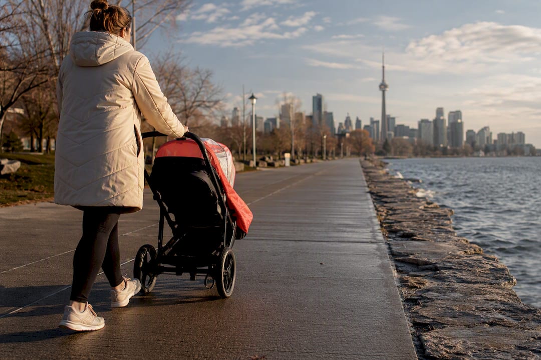
- Best for kids and strollers: Humber Bay Park and the western stretch of the Martin Goodman Trail. Paved, flat, and close to parking off Lakeshore Boulevard West. Wide enough for a double stroller without dodging cyclists.
- Best for a long bike ride: Martin Goodman Trail, end to end. It runs roughly 22 km from Humber Bay to the Beaches, fully paved, and lined with Bike Share Toronto docking stations most of the way.
- Best for paddling or a beach afternoon: Toronto Islands. Take the ferry from the Jack Layton Ferry Terminal, then walk or rent a kayak once you’re across.
- Best for birding and wildlife: Tommy Thompson Park (the Leslie Spit). Packed gravel, no crowds most weekdays, and one of the few spots in the city where you’ll see herons up close.
- Best for a view (and a bit of a climb): Scarborough Bluffs. Not stroller territory, but the payoff is the best skyline shot on the lake.
Each of these connects to the larger Great Lakes Waterfront Trail network, so you can download the exact route before you leave the driveway. The city’s own Martin Goodman page also breaks down surface types and connection points if you want the engineering detail rather than the summary.
Where to get the maps and how far you’re actually walking
Skip guessing distances from a map thumbnail. The Waterfront Trail’s own map pages let you pull an interactive route or a PDF for offline use, and they post closures before you drive out for nothing.
Pro Tip: Download the PDF the night before, not at the parking lot. Cell signal near the Leslie Spit and parts of the Islands is patchy, and a stuck loading map wastes the fifteen minutes you had before the kids get hungry.
A few numbers worth knowing before you plan a route:
- Martin Goodman Trail: about 22 km end to end, Humber Bay to the Beaches.
- The trail system across the city splits into three zones, Etobicoke, Central Toronto, and Scarborough, each with different surface quality.
- The full Great Lakes Waterfront Trail runs roughly 3,600 km around the Great Lakes, of which Toronto’s stretch is a small but well-serviced slice.
If you’re heading to the Islands, check the ferry schedule before you leave home. Queues build fast on warm Saturdays, and a missed sailing eats your whole morning.
What to expect at each trail: surface, parking and stroller notes
-
Martin Goodman Trail. Fully paved along most of its length, with Bike Share Toronto stations spaced every few blocks. The Harbourfront section near Queens Quay gets busy by late morning, especially on weekends, thanks to wide dedicated bike lanes that draw both cyclists and pedestrians. Park at Humber Bay Park West or along the Beaches strip near Woodbine. Stroller-friendly the entire way. Best window: weekday mornings before 10:00, or June and September weekends when the crowds thin out.
-
Toronto Islands. Catch the ferry at the Jack Layton Ferry Terminal, foot of Bay Street. Once on Centre Island or Ward’s Island, paths are mostly paved or packed gravel, flat enough for strollers. Washrooms are near the main ferry docks and at Centreville. Paddleboard and kayak rentals operate out of several harbourfront operators near Queens Quay, a short walk from the ferry terminal on the mainland side. Buy ferry tickets online if you can. Lines at the ticket booth on a sunny Saturday can run past 30 minutes.
-
Tommy Thompson Park (Leslie Spit). Packed gravel throughout, no washrooms once you’re past the entrance gate, and limited parking that fills by mid-morning on nice days. This is a birding destination first, and dog-free, bike-slow zone rules apply on weekends. Bring water. There’s no coffee cart out there.
-
Humber Bay Park. A family-friendly loop with boardwalks over the wetlands and good sightlines for spotting waterfowl. Parking off Lakeshore Boulevard West is generous compared to downtown lots. Stroller-friendly on the main loop; the wetland boardwalk narrows in spots.
-
Scarborough Bluffs. Uneven terrain, steep stairs down to the beach at Bluffer’s Park, and lookout parking that’s limited at the top. Keep kids well back from the cliff edge itself and stick to marked lookout areas rather than the unofficial trails along the rim. One stretch of trail behind St. Augustine Seminary is unpaved and turns to mud after rain, so this is not the spot for a jogging stroller on a wet day.
A timed Saturday plan from Richmond Hill or downtown
This is the plan you can actually follow without opening another tab.
- 8:30 AM: Leave Richmond Hill (about 40 minutes to Humber Bay via the Don Valley Parkway and Gardiner Expressway, traffic-dependent) or downtown Toronto (15 to 20 minutes west along Lake Shore Boulevard). Park at Humber Bay Park West, off Marine Parade Drive. The lot is free and rarely full before 10:00 on a weekday, but often fills quickly by mid-morning on busy summer weekends. If it’s full, the overflow lot on the east side of the park usually has room.
- 9:00 AM: Walk or wheel the paved loop through Humber Bay Park East and West. Washrooms are near the west parking lot. Allow 40 minutes for a stroller pace with stops at the water’s edge.
- 9:45 AM: Head east on the Martin Goodman Trail toward Sunnyside. It’s paved, flat, and roughly 20 minutes by bike or an hour on foot to reach Coronation Park.
- 11:00 AM: Stop for coffee or an early lunch along Queens Quay near the Harbourfront Centre. Plenty of casual, family-friendly spots line the strip, most with outdoor seating that works fine with a stroller parked beside the table.
- 12:00 PM: If the kids still have energy, walk the last stretch to the ferry docks and consider a short Island crossing for the afternoon. Otherwise, call it here. You’ve covered three of the city’s best waterfront stretches in under four hours.
How DayHop turns this into your own personalised day
That plan above works as written, but weather, nap schedules, and kid energy levels don’t always cooperate. The planner adjusts for weather and lets you swap in kid-friendly stops without starting from scratch. If you want the longer-ride version of this route, read Best Bike Trails In Toronto, and if the Islands are your main event, Plan A Family Toronto Islands Day Trip has the ferry timing worked out already. Build your own version at Dayhop.
Where to check maps, closures and ferry times
- Great Lakes Waterfront Trail: Home for the full interactive map and closures.
- Toronto section pages for zone-by-zone surface details.
- City of Toronto’s Unwin Avenue Connection page for Martin Goodman Trail specifics.
- Harbourfront paddling operators for kayak, canoe and SUP rentals near Queens Quay.
What actually matters when you plan this trip
Most guides treat Toronto’s waterfront like one continuous ribbon of trail you can just show up and follow. It isn’t. The surface, crowd level, and stroller suitability change block by block, and the gap between the polished Queens Quay section and the muddy stretch behind St. Augustine Seminary is the difference between a pleasant hour and a ruined stroller.
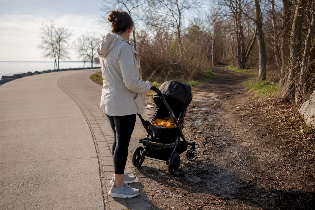
The conventional advice leans hard on distance figures, “walk the full 22 km,” without mentioning that nobody with small kids is doing that in one sitting, and that parking at the popular western lots evaporates by mid-morning on a warm weekend. The number that matters more than total trail length is arrival time. Get to Humber Bay Park or the Beaches lots before 10:00, or build in a transit backup, because the parking crunch is the single most predictable failure point in a Toronto waterfront day.
If you take one thing from this: pick your stretch based on stroller needs and parking realities first, scenery second. The bluffs look better in photos than they feel with a toddler in tow.
— Mugendi
Sources
- Great Lakes Waterfront Trail: Home
- Toronto | Great Lakes Waterfront Trail
- Unwin Avenue Connection – Martin Goodman Trail
- Things to Do in Toronto: Kayaking, Canoeing & Paddleboarding
FAQ
What are some good lakeshore trails in Toronto?
The Martin Goodman Trail, the Toronto Islands paths, Tommy Thompson Park, and Humber Bay Park cover the main options, each suited to a different kind of day, from a flat family stroll to a longer bike ride.
What are the best trails to go around Toronto?
For walking or a family cycle, the Martin Goodman Trail and Humber Bay Park are the most reliable choices, with paved surfaces and steady parking. For something quieter, Tommy Thompson Park offers gravel paths and far fewer people.
Can you walk along the waterfront in Toronto?
Yes. Most of the downtown and western waterfront, including the Martin Goodman Trail and Queens Quay, is fully walkable on paved paths, though some eastern stretches near Scarborough include unpaved and uneven sections.
How long is the Toronto Waterfront Trail?
The Martin Goodman Trail, Toronto’s core waterfront route, runs about 22 km from Humber Bay to the Beaches. It connects into the much larger Great Lakes Waterfront Trail, which spans roughly 3,600 km around the lakes.
Recommended
Plan my day →