Hikes near Toronto: best day trips for GTA residents
Hikes near Toronto: best day trips for GTA residents
The best hikes near Toronto split into two easy categories: in-city trails you can reach by TTC, and short-drive escapes that feel worlds away. For a quick urban fix, the Don Valley ravine network, Humber River Recreation Trail, and Scarborough Bluffs are hard to beat. Got a car and a free morning? The Niagara Escarpment’s Bruce Trail sections near Milton deliver cliff-top drama roughly 45–60 minutes from downtown.
Pick by time and mood:
- 30 minutes or less, no car needed: Crothers Woods, Charles Sauriol Conservation Area, West Toronto Railpath (2.1 km asphalt), Taylor Creek Park, Earl Bales Park, Highland Creek system, Sun Valley Trail
- 30–60 min drive: Rouge National Urban Park (forests, marshland, Lake Ontario beach), Scarborough Bluffs Trail, an easy route with dramatic cliffs above the lake
- 45–60 min drive, escarpment day trip: Rattlesnake Point + Crawford Lake via the Bruce Trail, Mast Trail in Rouge
🌍 The Niagara Escarpment is roughly 450 million years old — those limestone cliffs near Milton are ancient geology you can walk on in an afternoon.
Many of the top hikes within an hour of Toronto work as half-day outings. Urban trails are the transit-friendly choice; the escarpment is worth the drive when you want real wilderness energy.
Key takeaways
The best hiking trails near Toronto reward you most when you match the trail to your time, transport, and energy level before you leave the house.
| Point | Details |
|---|---|
| Pick by time and transport | In-city ravine trails need no car; escarpment hikes need 45–60 min drive and parking prep. |
| Pack the right kit | Water, grippy footwear, tick spray, and a charged phone cover most GTA trail conditions. |
| Check parking and hours | Rouge lots lock at 9 PM; Rattlesnake Point fills fast on summer weekends — arrive early. |
| Seasonal awareness | Spring mud, summer heat, fall crowds, and winter ice each call for different gear and timing. |
| Use Dayhop to plan | Dayhop filters GTA trails by drive time, family needs, and weather for a ready day plan. |
Table of Contents
- What are the trail rules you should follow?
- What amenities can you find at Toronto-area trails?
- How does GTA weather affect your hiking plans?
- A local perspective on planning your GTA hike
- Dayhop turns your trail pick into a ready-made day plan
- Sources
What are the trail rules you should follow?
Yield to uphill hikers on narrow paths. Keep dogs on leash in all City of Toronto parks and Rouge National Urban Park. Pack out everything you pack in. Stay on marked trails, especially near cliff edges at Scarborough Bluffs and Rattlesnake Point. Keep noise low in wildlife corridors like the Rouge. The City of Toronto trails page lists specific rules for each multi-use trail, including the Trans Canada Trail segments that run through the city.
What amenities can you find at Toronto-area trails?
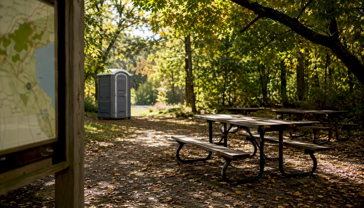
It varies a lot by trail type. City ravine trails (Humber River Recreation Trail, Crothers Woods) have washrooms at trailheads and occasional water fountains. Rouge National Urban Park has portable toilets seasonally at the Mast Trail and picnic areas near the main visitor zones. Scarborough Bluffs Park has washrooms and a café nearby. Escarpment spots like Rattlesnake Point (Conservation Halton) have washrooms and picnic tables at the main lot. Food options are mostly bring-your-own on trail; plan a post-hike stop in the nearest town.
How does GTA weather affect your hiking plans?
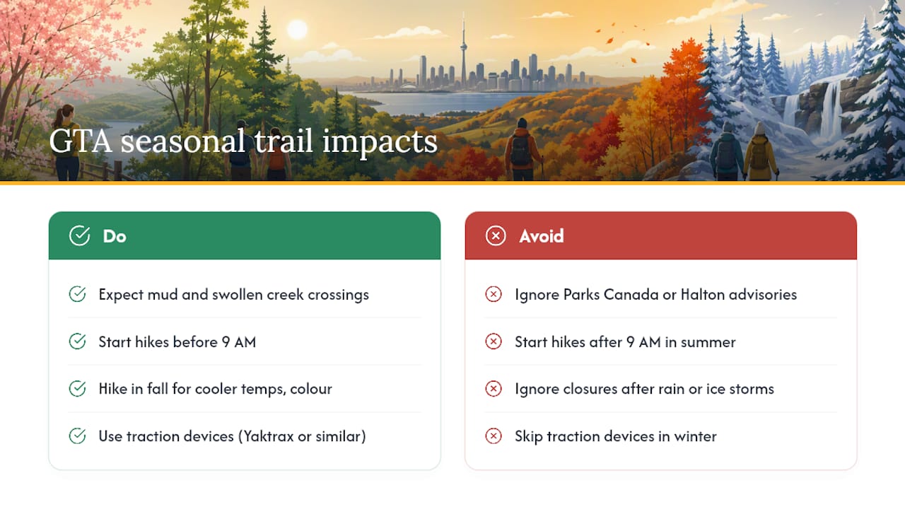
Spring (April–May) means mud on natural-surface trails and swollen creek crossings. Summer is peak season: start before 9 AM to beat heat and parking crowds. Fall is the sweet spot — cooler temps, colour, and firm ground. Winter trails stay open but icy boardwalks and frozen mud demand traction devices (Yaktrax or similar). Rouge and escarpment trails can close sections after heavy rain or ice storms, so check Parks Canada bulletins and Conservation Halton advisories before you leave.
A local perspective on planning your GTA hike
When I have two hours and no car, the Don Valley ravine is the call. When I have a full morning and want to feel genuinely far from the city, Rattlesnake Point wins every time. The cliffs there feel cinematic in a way no city trail can match.
Pro Tip: Arrive at Rouge National Urban Park before 8 AM on weekends. Parking is free but extremely limited, and lots lock at 9 PM. Miss that window and you’re either circling or stranded.
The real planning trap is underestimating drive-plus-parking time. A “45-minute drive” to Rattlesnake Point can become 90 minutes on a summer Saturday once you factor in the 401 and a full lot. Build in buffer, or use transit where it exists.
Dayhop turns your trail pick into a ready-made day plan
Choosing a trail is the easy part. Figuring out drive time, parking, what to do after, and whether it works for the whole group? That’s where most plans stall.

Dayhop builds a complete GTA day plan around your hike in seconds. Filter by drive time from your neighbourhood, family-friendly or rugged terrain, transit access, and current weather. Adjust on the fly if the lot is full or the weather shifts. Free users get a solid daily plan; Pro unlocks multi-stop itineraries and saved favourites for repeat weekends. Plan your next GTA hike with Dayhop and skip the Sunday-morning scramble.
Sources
Check these before you head out:
- 15 Best Hikes Near Toronto You’ll Love (2024)
- This Bruce Trail Hike Near Toronto Feels Like Banff
- Rouge National Urban Park
- Trails | City of Toronto
Parks Canada advises all Rouge visitors to check bulletins before arriving. Small operational details — locked lots, seasonal washroom closures, trail reroutes after rain — can meaningfully change your day.
Recommended
Plan my day →