Best bike trails in Toronto: maps, routes, and tips
Best bike trails in Toronto: maps, routes, and tips
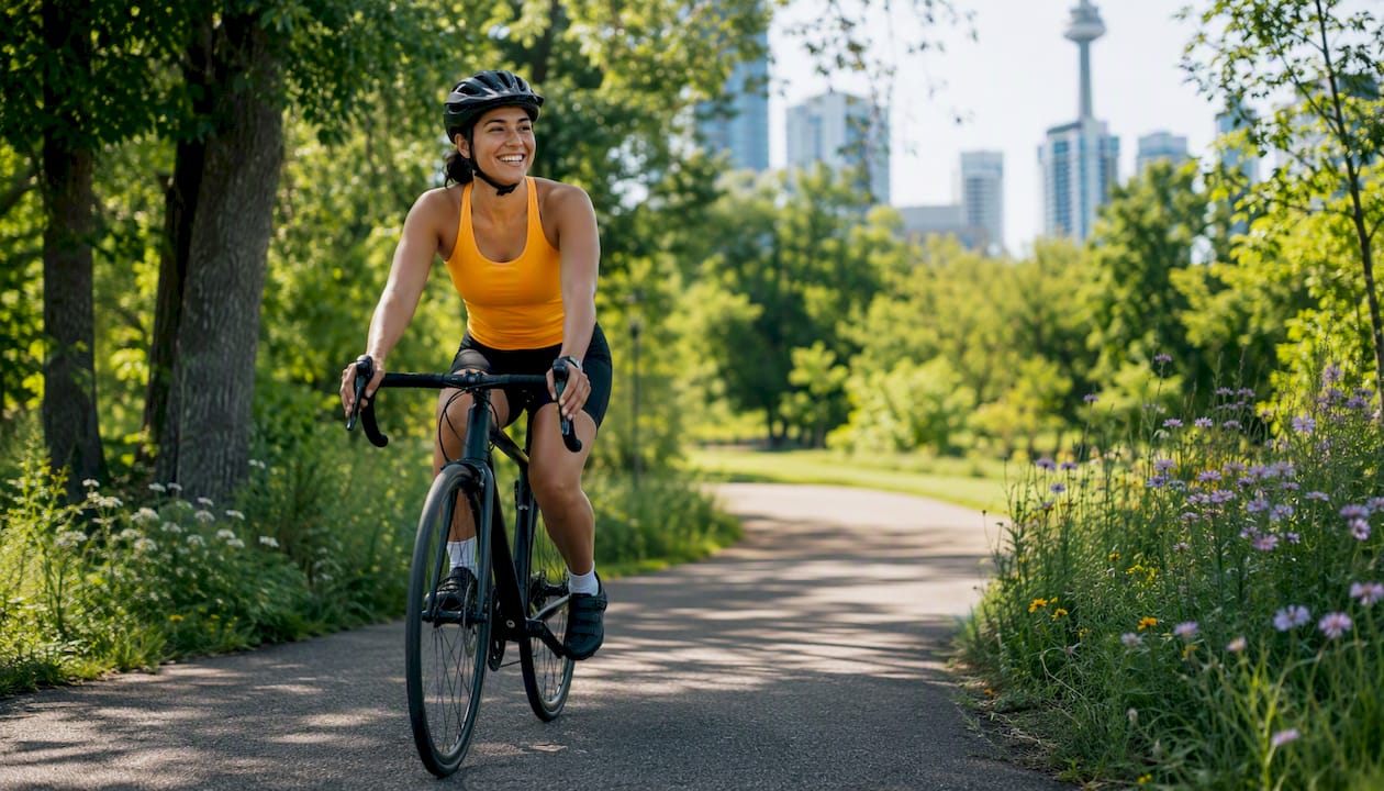
Toronto’s best bike trails are the Martin Goodman waterfront route, the Humber River Recreational Trail, the Don Valley ravine network, the Toronto Islands loop, the Meadoway, Tommy Thompson Park, the High Park loop, and the Finch Hydro Corridor. You can plan any of these rides using the City of Toronto Cycling Network Map, which shows on- and off-street bikeways, Bike Share station locations, and suggested routes. Paper copies are available at Toronto Public Library branches, community centres, and the City Hall 311 desk. Before a longer ride, cross-check with the Road Restrictions PDF for any closures affecting connectors.
Here’s a quick match to get you started:
- 🌊 Beginners and families: Martin Goodman waterfront sections, High Park loop, Toronto Islands
- 🌿 Scenic and nature rides: Tommy Thompson Park, Meadoway, Humber River trail
- 🏙️ Commuters: Lower Don Trail, Martin Goodman central sections
- 🪨 Gravel and adventure: Meadoway, Don Valley connectors, Finch Hydro Corridor
Key takeaways
Toronto’s best cycling routes combine flat waterfront paths, ravine wilderness, and cross-city connectors, and the City of Toronto Cycling Network Map is the single most reliable tool for planning any of them.
| Point | Details |
|---|---|
| Start with the official map | The City of Toronto Cycling Network Map shows bikeways, Bike Share docks, and suggested routes in one place. |
| Match trail to experience | Waterfront routes give lake views; ravine trails feel like wilderness. Pick by mood, not just distance. |
| Check closures before long rides | Download the Road Restrictions PDF to catch multi-year connector closures that standard apps miss. |
| Bike Share suits the waterfront | Docks are dense downtown and along the harbourfront; bring your own bike for ravine and gravel trails. |
| Dayhop builds the full day | Use Dayhop to stitch trails, café stops, and transit options into one exportable itinerary. |
Table of Contents
- What are the best bike trails in Toronto right now?
- How do you use the City of Toronto Cycling Network Map to plan a ride?
- Getting to the trails: parking, transit, and bike rentals
- Safety and seasonal tips every Toronto cyclist should know
- Which trail suits your ride today?
- Three ready-to-ride Toronto bike day itineraries
- What riding Toronto’s trails actually teaches you
- Build your perfect Toronto bike day with Dayhop
- Sources
What are the best bike trails in Toronto right now?
Each trail below comes with the facts you actually need: distance, surface, difficulty, who it suits, and where to start.
Martin Goodman Trail (waterfront)
Distance: covers a long waterfront stretch end-to-end (most riders do manageable sections) | Surface: Paved | Difficulty: Easy
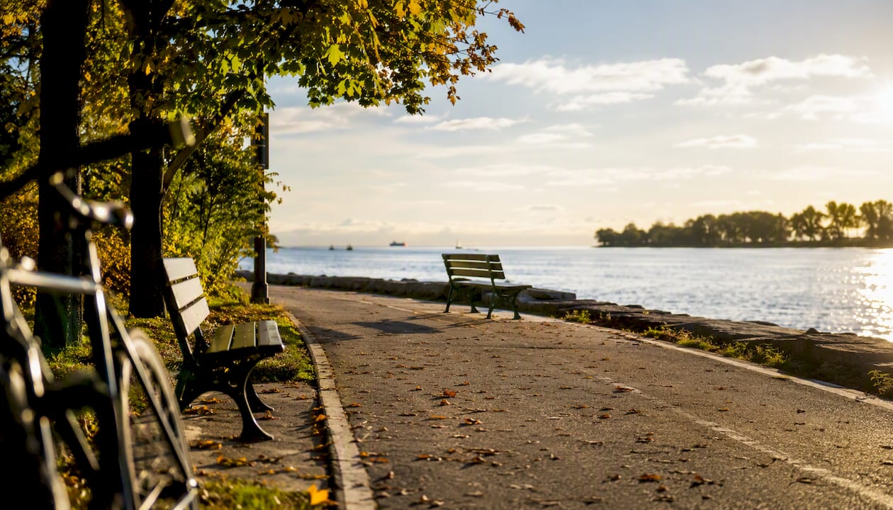
Toronto’s waterfront spine runs from the Humber River in the west to the Beaches in the east. Central sections are flat, wide, and fully paved, making this the go-to for commuters and anyone who wants a relaxed ride with lake views. Start at Harbourfront Centre (Queens Quay W) with easy TTC access via Union Station. Bike Share docks are dense along the waterfront.
Humber River Recreational Trail
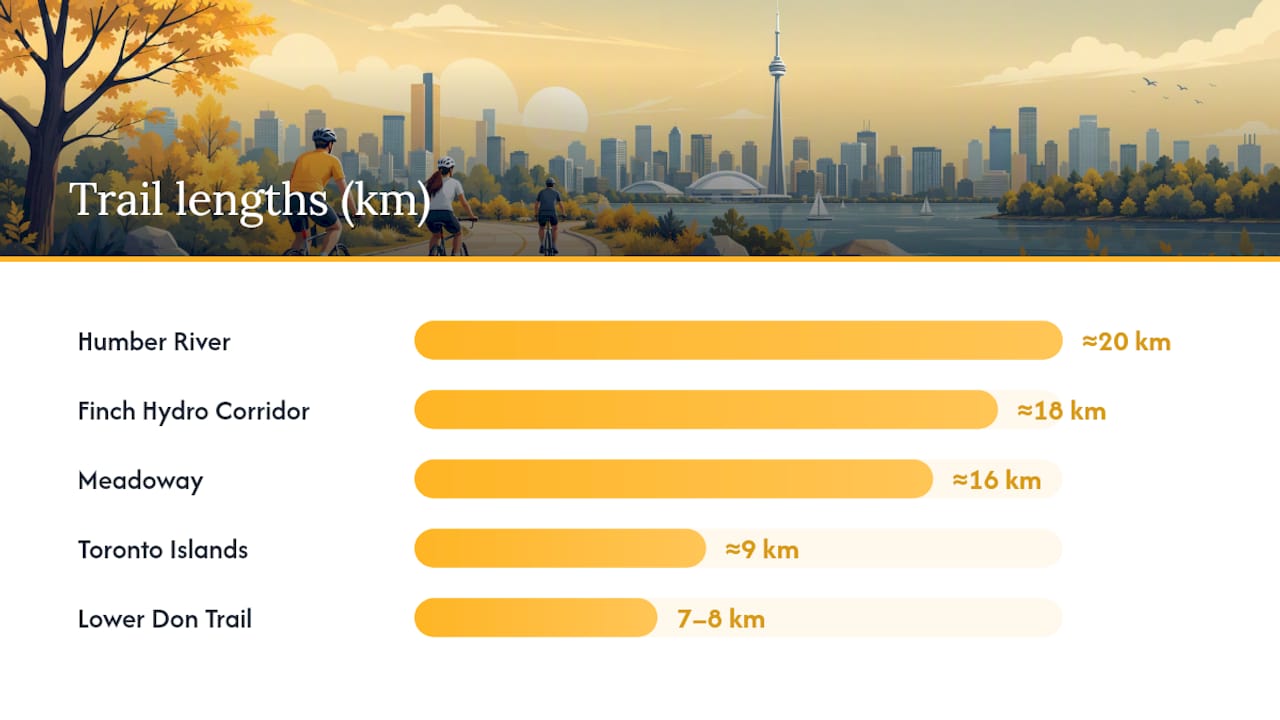
Distance: about twenty kilometres | Surface: Paved + packed gravel | Difficulty: Easy to moderate
This trail runs north from the lake through Etobicoke toward North York, connecting to the Finch Hydro Corridor. The mix of pavement and packed gravel keeps it interesting without being technical. Start at Humber Bay Park East (parking available) or take the TTC to Royal York Station and ride south.
Lower Don Trail
Distance: 7–8 km | Surface: Fully paved | Difficulty: Easy
The Lower Don Trail is the fastest off-road route into downtown from the east side. It’s smooth and quick, though a few underpass sections narrow noticeably and the lakeshore end can flood briefly after heavy rain. Start at Evergreen Brick Works (parking + café) or take the TTC to Broadview Station.
Toronto Islands loop
Distance: approximately nine kilometres for the loop | Surface: Paved and packed paths | Difficulty: Easy
Car-free and completely flat, the Islands loop is one of the most relaxed rides in the city. Take the ferry from Jack Layton Ferry Terminal (foot of Bay Street) and rent a bike on the island or bring your own. Weekends fill up fast in summer, so aim for a weekday morning or early Saturday.
Meadoway (Scarborough)
Distance: about sixteen kilometres | Surface: Paved + natural surface | Difficulty: Easy to moderate
The Meadoway cuts through Scarborough’s hydro corridor and is one of Toronto’s newer off-road routes. The natural surface sections give it a slightly wilder feel than the waterfront. Access from Warden Station (TTC) or park at Warden Woods.
Tommy Thompson Park (Leslie Street Spit)
Distance: roughly five kilometres one way | Surface: Packed gravel/crushed stone | Difficulty: Easy
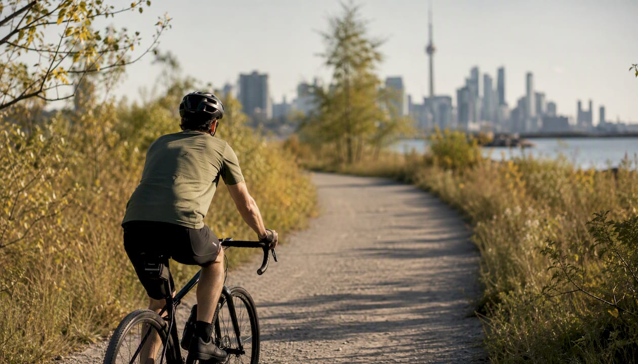
Tommy Thompson Park is car-free on weekends and holidays, which makes it genuinely peaceful. The skyline views from the tip of the spit are worth the ride alone. Start at the main gate on Leslie Street, south of Commissioners Street. No Bike Share docks here, so bring your own or rent nearby.
High Park loop
Distance: around five to six kilometres for the loop | Surface: Paved roads and paths | Difficulty: Easy
High Park’s internal roads and paths form a pleasant loop through gardens, a small zoo, and Grenadier Pond. It’s ideal for families and casual riders. Access via High Park Station (TTC) or park along Bloor Street W. Busy on summer weekends, so early morning is your best window.
Finch Hydro Corridor
Distance: approximately eighteen kilometres | Surface: Paved + packed gravel | Difficulty: Easy to moderate
Running east-west across the top of the city, the Finch Hydro Corridor connects the Humber River trail to the Don Valley system. It’s a practical commuter connector and a surprisingly green ride for how far north it sits. Access from Finch West Station (TTC) at the western end.
| Trail | Length | Surface | Best for |
|---|---|---|---|
| Martin Goodman | long sections spanning much of the waterfront | Paved | Commuters, scenic rides |
| Humber River | approximately twenty kilometres | Paved + packed gravel | Ravine scenery, connectors |
| Lower Don Trail | 7–8 km | Paved | Fast downtown access |
| Toronto Islands | around nine kilometres for the loop | Paved + packed paths | Families, casual riders |
| Meadoway | about sixteen kilometres | Paved + natural surface | Adventure, nature |
| Tommy Thompson Park | roughly five kilometres one way | Packed gravel | Nature, photography |
| High Park loop | about five to six kilometres | Paved | Families, beginners |
| Finch Hydro Corridor | approximately eighteen kilometres | Paved + packed gravel | Commuters, cross-city |
How do you use the City of Toronto Cycling Network Map to plan a ride?
The City of Toronto Cycling Network Map is your best starting point. Here’s how to get the most out of it:
- Open the map at toronto.ca on desktop or mobile. The interactive version loads layers for cycle tracks, painted lanes, multi-use paths, and suggested routes.
- Toggle bikeway types using the legend. Cycle tracks (physically separated) and multi-use trails are the safest options for new riders; painted lanes suit more confident cyclists.
- Locate Bike Share docks by enabling the Bike Share Toronto layer. Docks cluster heavily in the downtown core and along the waterfront, making them easy to spot for point-to-point planning.
- Check the Road Restrictions PDF before any ride longer than 20 km. Multi-year construction closures can affect key connectors, including underpasses near Highway 401. Download the current PDF and scan for your planned corridor.
- Plan your start and end points by matching your nearest TTC stop or parking area to a trailhead shown on the map.
- Export or screenshot your route. The City map doesn’t offer GPX export natively, so screenshot your planned corridor. For turn-by-turn navigation, load the same route into OpenStreetMap, which provides the mapping data many route apps use and supports GPX export for offline use.
CycleTO’s route-planning guide recommends matching your reason to ride with the network type first, then designing the route around safe crossings and verified surface conditions.
Pro Tip: Before a long ride, export a GPX file from OpenStreetMap or a compatible app like Komoot and load it onto your phone. Cell signal drops in some ravine sections, and having an offline map saves a lot of guesswork at trail junctions.
Getting to the trails: parking, transit, and bike rentals
Arriving by TTC or GO
Most major trailheads sit within a short ride of a TTC station. Union Station puts you minutes from the waterfront and Bike Share docks. Broadview Station is the natural start for the Lower Don Trail. High Park Station drops you at the park entrance. Finch West Station anchors the western end of the Finch Hydro Corridor.
GO Transit riders can bring bikes on most trains outside peak hours, which opens up longer point-to-point rides. Ride the GO to Hamilton or Oakville and connect back to the Waterfront Trail for an extended day out.
Parking at trailheads
- Humber Bay Park East: Free parking, busy on summer weekends. Arrive before 9 AM.
- Evergreen Brick Works: Paid parking, café on site. Good base for Don Valley rides.
- Tommy Thompson Park gate: Street parking on Leslie Street, limited spots.
- High Park: Paid lots inside the park; street parking on Bloor Street W fills quickly.
- Meadoway (Warden Woods): Free parking, accessible from Warden Avenue.
Bike Share Toronto
Bike Share Toronto docks are densest in the downtown core and along the harbourfront. A day pass gives you unlimited 30-minute rides, which covers most waterfront hops between docks. For longer stretches, plan your dock stops in advance using the City map’s Bike Share layer. The bikes are sturdy commuter-style, so they’re better suited to flat waterfront sections than gravel trails or ravine connectors.
Bring your own bike for the Meadoway, Tommy Thompson Park, or any Humber River section north of Bloor Street, where docks thin out considerably.
Safety and seasonal tips every Toronto cyclist should know
Seasonal conditions
- Spring (March–May): Ravine trails can be muddy or icy well into April. Low-lying sections of the Lower Don Trail may flood after heavy rain. Wait a day or two after a big storm before riding the ravines.
- Summer (June–August): Waterfront trails get crowded on weekends and holidays. Tommy Thompson Park fills up fast on long weekends. Early morning starts (before 9 AM) give you the trail to yourself.
- Autumn (September–November): Arguably the best riding season. Cooler temps, fewer crowds, and the ravines turn spectacular. Watch for wet leaves on paved paths, which get slippery fast.
- Winter (December–February): Some trails are maintained for winter cycling (parts of the Martin Goodman), but ravine sections and gravel paths are generally not cleared. Check the City’s maintenance schedule before heading out.
Trail etiquette and safety basics
- Call out “passing on your left” before overtaking pedestrians or slower cyclists.
- Slow to a walking pace through narrow underpasses, especially on the Lower Don Trail.
- Lights front and rear are required by Ontario law after dark, and a helmet is mandatory for riders under 18.
- Carry a small pump and a spare tube. Flats happen, and the nearest bike shop can be a long walk from a ravine trail.
Pro Tip: Check the City of Toronto Road Restrictions map the day before any ride that uses underpasses or highway-adjacent connectors. Some closures run for multiple years and won’t show up on standard mapping apps.
Which trail suits your ride today?
The choice between waterfront and ravine is really about the experience you want. Local riders describe it well: waterfront routes give you wide, horizontal city-and-lake views, while ravine systems feel like a vertical escape into urban wilderness. Pick your mood, then match the trail.
- 👨👩👧 Family outing: High Park loop, Toronto Islands, flat waterfront sections of the Martin Goodman
- 🏋️ Training and long distances: Martin Goodman end-to-end, Finch Hydro Corridor + Humber River combo
- 📸 Photography and scenery: Tommy Thompson Park (skyline views), Meadoway (wildflower meadows), Don Valley (ravine canopy)
- 🚴 Daily commute: Lower Don Trail (fastest downtown access), Martin Goodman central section, Finch Hydro Corridor
- 🪨 Gravel and adventure: Meadoway natural surface sections, Don Valley connectors, Humber River north of Bloor
- 🌅 Slow morning ride: Toronto Islands loop, High Park, Tommy Thompson Park on a quiet weekday
Surface matters as much as distance. Gravel and natural surface trails need wider tyres (32mm or more). The Martin Goodman and Lower Don are fine on road bikes. The Meadoway and Humber River north sections are better on a hybrid or gravel bike.
Three ready-to-ride Toronto bike day itineraries
Ontario By Bike’s seven self-guided Toronto day tours are a great model for pairing trail segments with food and cultural stops. Here are three itineraries built around the trails above.
1. Waterfront half-day loop (20–25 km, paved, easy)
Start: Union Station (TTC) or Bike Share dock at Queens Quay W Estimated time: 2.5–3.5 hours including stops
- Head west along the Martin Goodman Trail toward Humber Bay Park East (~11 km).
- Stop at Humber Bay Shores for a coffee at one of the cafés along Marine Parade Drive.
- Loop back east along the waterfront, stopping at Harbourfront Centre or the Distillery District (short detour north on Cherry Street).
- Return bike to any Bike Share dock near Union Station.
Highlights: Lake Ontario views the whole way, Humber Bay Arch Bridge, Harbourfront patios. Transit fallback: TTC streetcar along Queens Quay if you run short on time.
2. Ravine training loop: Humber + Finch Hydro Corridor (~38 km, mixed surface, moderate)
Start: Humber Bay Park East (parking) or Royal York Station (TTC) Estimated time: 3–4 hours
- Ride north on the Humber River Recreational Trail (~20 km to Finch Avenue).
- Turn east onto the Finch Hydro Corridor (~18 km toward the Don Valley).
- Drop south into the Don Valley trail system and return downtown via the Lower Don Trail (7–8 km to the lake).
- Ride west along the waterfront back to your start point.
Highlights: Humber River gorge, open hydro corridor views, Don Valley ravine canopy. Note: Pack snacks. Food stops are sparse on the Finch Corridor. Evergreen Brick Works (near the Don Valley end) has a café and a farmers’ market on weekends.
3. Islands + Leslie Spit nature loop (~20 km, mixed, easy)
Start: Jack Layton Ferry Terminal (foot of Bay Street, TTC to Union Station) Estimated time: 3–4 hours including ferry
- Take the ferry to Ward’s Island. Ride the island loop (~9 km), stopping at the Rectory Café on Ward’s Island for brunch.
- Return by ferry to the mainland and ride east along the waterfront to the Tommy Thompson Park gate on Leslie Street (~5 km).
- Ride the spit out and back (~10 km return) for skyline views and birdwatching.
- Return west along the waterfront to Union Station or pick up a Bike Share dock.
Highlights: Car-free island roads, Rectory Café, Tommy Thompson Park skyline panorama, waterbird colonies on the spit. Transit return: TTC 83 Jones bus from Leslie and Commissioners if legs are tired.
What riding Toronto’s trails actually teaches you
There’s a gap between what a map shows and what a trail feels like at 8 AM on a Tuesday in October. The Martin Goodman looks like a simple waterfront path on paper, but ride it on a long weekend afternoon and you’re navigating a slow-moving crowd of strollers, e-scooters, and tourists. The same route at 7 AM on a weekday is a completely different ride: fast, quiet, and genuinely lovely.
The ravine trails have their own rhythm. The Don Valley and Humber systems feel surprisingly remote for a city of this size. That sense of escape is real, not a marketing line. But ravine trails also demand more attention: wet roots in spring, narrow underpasses where you need to slow right down, and junctions that aren’t always clearly signed.
The most underrated tip for Toronto cycling isn’t about gear or fitness. It’s timing. Crowds on the waterfront and at High Park peak between 11 AM and 3 PM on weekends. Arriving an hour before that window, or waiting until late afternoon, changes the whole experience. The same trails that feel congested at noon feel spacious by 5 PM.
Dayhop is the tool I use when I want to turn a bike ride into a proper day out. It pulls together the trail, a café stop, and a post-ride destination into one plan, adjusting for weather and timing so nothing feels like guesswork.
Build your perfect Toronto bike day with Dayhop
You’ve got the trails, the maps, and the itineraries. The last piece is putting it all together without spending 45 minutes cross-referencing tabs.
Dayhop builds a personalised day plan around your ride. Tell it your preferred trail, your start time, and what kind of stops you want (coffee, lunch, a nature detour, a post-ride patio), and it lays out a full itinerary with weather-aware timing and real venue suggestions. Plans adjust on the fly if you finish a trail early or want to add a stop. No rigid schedule, just a smart starting point you can tweak as the day unfolds.

Head to Dayhop to build and export your bike-day itinerary before your next ride.
Sources
Good rides start with good information. Here’s where to look:
- Cycling Network Map
- Toronto Bike Trails: 7 Best Routes for Rides & Commutes
- Lower Don Valley Trail – Don Valley Trail Guide & Map | Toronto Biking
- Toronto Cycling Day Tour Itineraries - Ontario By Bike
- How to plan your bike route
- Openstreetmap
- Toronto’s 7 best bike rides
When to use each: Pull up the City map and Road Restrictions PDF the day before any ride over 20 km. Use Ontario By Bike and CycleTO for itinerary inspiration when you’re planning a full day out. Check Toronto Biking for trail-specific surface and seasonal notes before heading into the ravines.
Recommended
Plan my day →