Toronto's street art scene: your map-first guide
Toronto’s street art scene: your map-first guide
Toronto’s street art scene is one of the most accessible open-air galleries in Canada, and the single best place to start is the StreetARToronto (StART) interactive map — a free, City-run resource that pins murals across the city with artist credits, photos, and project notes. Open it before you leave home. Then head to Graffiti Alley (Rush Lane) in the Fashion District for the highest concentration of murals per block, or swing west to Dundas Street West if you want neighbourhood storytelling over raw visual density.
Here’s what to bring and what to expect:
- 📷 Camera or a fully charged phone
- 👟 Comfortable walking shoes (cobblestones in Kensington, uneven laneways elsewhere)
- 🕐 Budget around 30 minutes for Graffiti Alley alone; a half-day covers two or three neighbourhoods comfortably
- 💧 Water, especially for a summer afternoon visit
Pro Tip: Murals change. A wall you saw in a photo last season may already be repainted. Cross-reference the StART map with the date stamps on its entries before you go, and treat any mural you find as a happy surprise rather than a guaranteed exhibit.
Key takeaways
Toronto’s street art scene rewards a map-first approach: open the StART interactive map, pick a neighbourhood cluster, and let the route come to you.
| Point | Details |
|---|---|
| Start with the StART map | The City of Toronto’s free interactive map shows mural locations, artist credits, and project notes across the city. |
| Graffiti Alley is the top stop | Rush Lane in the Fashion District is the most visited mural corridor, but works change frequently, so expect surprises. |
| Pair murals with public sculpture | The AGO’s Moments Contained at Dundas and McCaul pairs naturally with any Queen West or Graffiti Alley route. |
| Respect artists and spaces | Credit artists when posting photos online and stay on public sidewalks when photographing murals on private buildings. |
| Dayhop builds the route for you | Use Dayhop to cluster stops, set transit preferences, and adjust your plan on the fly for a smoother day out. |
Table of Contents
- What is the StreetARToronto (StART) map and how do you use it?
- Where is the best street art in Toronto? A neighbourhood-by-neighbourhood guide
- How to plan a self-guided street art walk in Toronto
- Guided tours, community programmes, and ways to get involved
- Photography etiquette and a few practical notes
- Build a street art day with Dayhop: a sample itinerary
- A favourite quick route worth trying
- Plan your street art day with Dayhop
- Sources
What is the StreetARToronto (StART) map and how do you use it?
The StreetARToronto programme is a City of Toronto initiative that grew out of the city’s Graffiti Management Plan. Since 2012, StART has transformed graffiti hot spots into community-engaged public art sites, supporting commissioned murals, artist calls, and public-realm improvements across the city. It is not a passive registry; it actively funds and coordinates new work.
The interactive map is the practical heart of StART for visitors. Each pin shows:
- The mural’s location and a photo
- The artist’s name and a short project description
- Whether the work was commissioned or community-initiated
- Notes on the programme stream that funded it
Using those filters lets you distinguish a freshly commissioned piece from older, unlisted work. That matters because the map also helps you avoid chasing a wall that has since been painted over.
Pro Tip: On the StART map, click the project-notes field for any pin. Commissioned works with a listed programme year tend to be more permanent than unlisted pieces. If the notes mention a BIA or community partner, the mural is usually maintained.
Where is the best street art in Toronto? A neighbourhood-by-neighbourhood guide
Toronto’s public art is spread across distinct pockets, each with its own character. Pick one or chain two together for a half-day out.
Graffiti Alley (Rush Lane), Fashion District
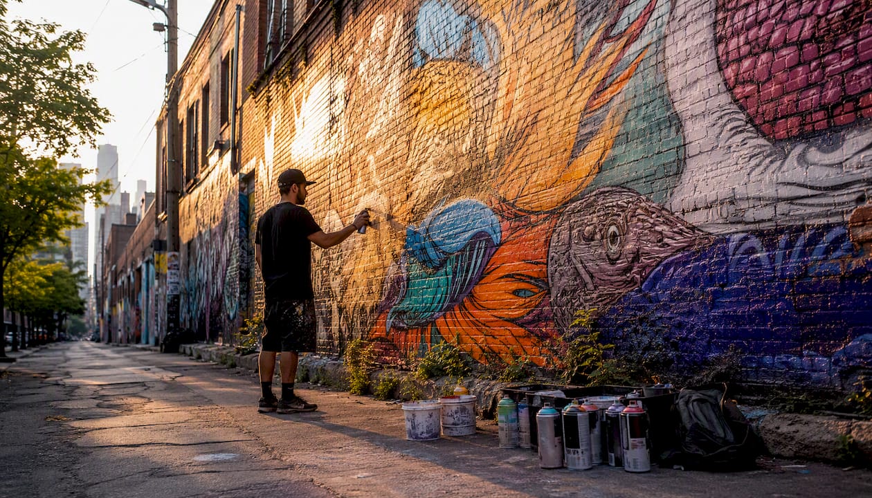
Graffiti Alley runs roughly three blocks along Rush Lane, south of Queen Street West between Spadina and Portland. It is widely considered a highly visited mural corridor in the city. Local guides trace its evolution from a contested graffiti spot to a de facto public-art corridor, though it is not classified as a fully legal permanent mural wall. Works are repainted regularly, so the wall you photograph today may look completely different in six months. Lonely Planet recommends pairing it with nearby cultural stops for a fuller visit. The AGO is a 10-minute walk north; the AGO’s Moments Contained by Thomas J Price, a nine-foot bronze public sculpture at Dundas Street West and McCaul Street, makes a natural pairing stop.
Access: Queen Street West streetcar (504), exit at Spadina. Walk south on Spadina, turn east on Rush Lane.
Queen Street West / West Queen West
West Queen West is Toronto’s most gallery-dense strip. Murals appear on side streets, parking structures, and building ends. The Queen Street West art crawl route documented by Destination Toronto pairs mural viewing with independent galleries and MOCA (Museum of Contemporary Art). Expect large-format works commissioned by local BIAs alongside spontaneous pieces.
Kensington Market
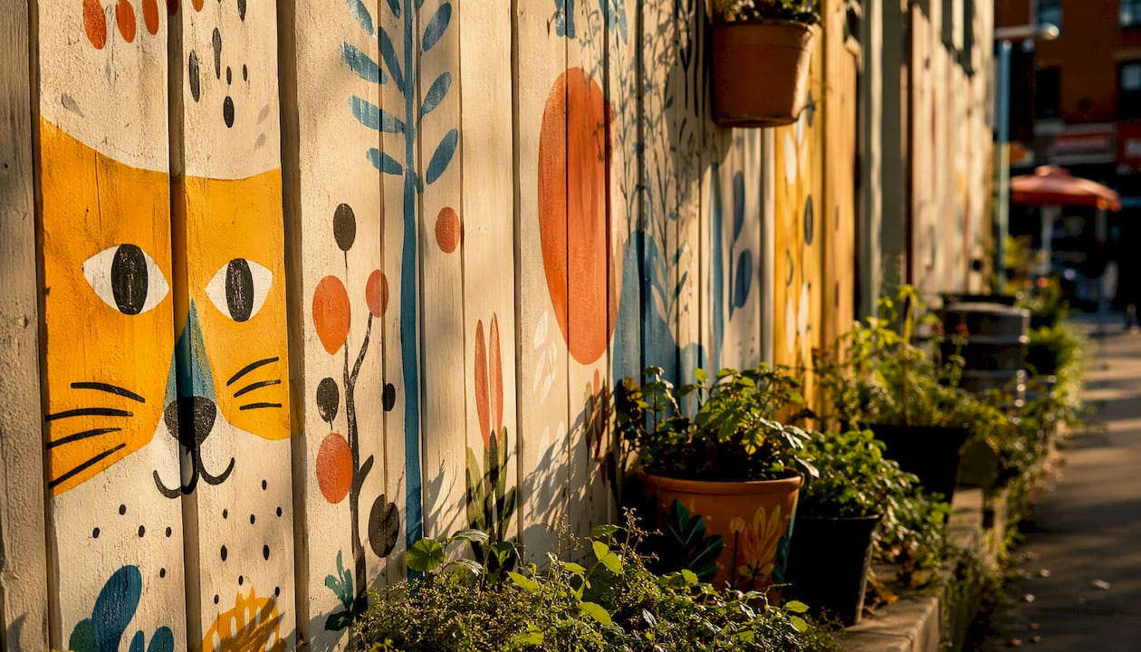
Kensington’s murals are woven into the market’s daily life: painted fences, colourful storefronts, and laneway walls. The scale is smaller than Graffiti Alley, but the density of detail rewards slow walking. Family-friendly and accessible by foot from Spadina station.
Dundas Street West Open Air Museum
Dundas Street West hosts a walkable collection of murals that tell neighbourhood stories, functioning as an informal open-air museum. Works here tend toward community narrative rather than abstract style, making it a good choice for first-time visitors who want context alongside colour.
Liberty Village
Liberty Village’s converted industrial buildings offer large blank walls that attract big-format commissions. Less foot-traffic than Queen West, which means better photography conditions on weekday mornings.
Underpass Park (Eastern Avenue Underpass)
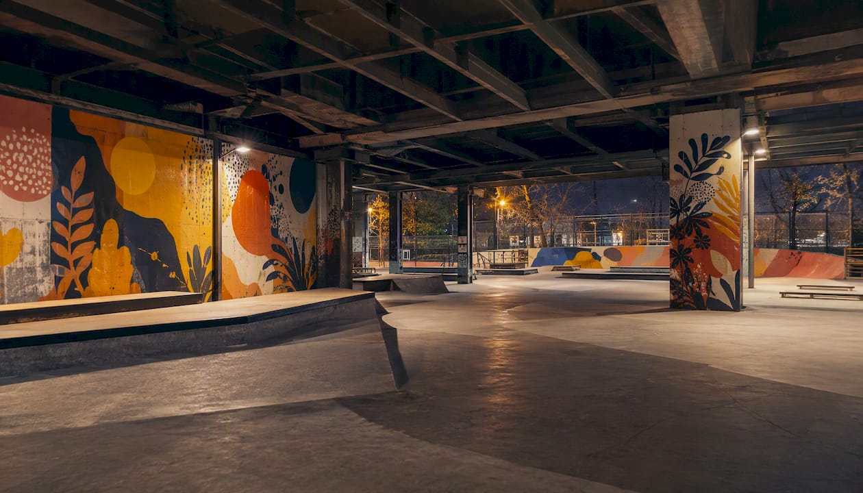
Underpass Park sits beneath the Eastern Avenue and Richmond Street East overpasses. The park combines public art, skate facilities, and community programming. The underpass walls feature rotating large-scale murals, and the space is active year-round.
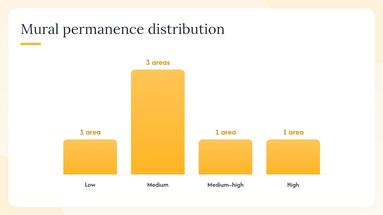
Choosing your spot at a glance
| Neighbourhood | Best for | Transit access | Mural permanence |
|---|---|---|---|
| Graffiti Alley | Photography, high density | Queen streetcar (504) | Low — frequent repaints |
| Queen Street West | Art crawl, galleries | Queen streetcar (504) | Medium |
| Kensington Market | Family-friendly, slow walk | Spadina streetcar (510) | Medium |
| Dundas Street West | Neighbourhood storytelling | Dundas streetcar (505) | Medium–high |
| Liberty Village | Large-format, low crowds | King streetcar (504A) | High |
| Underpass Park | Skate culture, all-ages | King streetcar (504A) | Medium |
How to plan a self-guided street art walk in Toronto
Turn the StART map into an actual afternoon out with this simple workflow.
Step-by-step planning:
- Open the StART interactive map and filter by neighbourhood.
- Pick two or three pins within walking distance of each other.
- Note the nearest TTC stop for your first pin.
- Screenshot or save the map offline before you leave home.
- Set a realistic time budget using the estimates below, then head out.
Three ready-to-use mini routes:
- Quick Queen West loop (1–1.5 hours): Start at Ossington station, walk east along Queen Street West to Bathurst, dip into side streets for murals, finish at Trinity Bellwoods Park. Transit: 501 Queen streetcar.
- Half-day Kensington + Dundas West (2.5–3 hours): Start at Spadina and College, walk through Kensington Market, continue south to Dundas Street West Open Air Museum, finish near Ossington. Transit: 510 Spadina streetcar to College.
- AGO + Graffiti Alley photo loop (2 hours): Start at St. Patrick station, walk south to Graffiti Alley via Rush Lane, then north to the AGO and the Moments Contained sculpture at Dundas and McCaul. Transit: Line 1 to St. Patrick.
What to pack:
- Fully charged phone or camera with extra battery
- Weather-ready layers (Toronto weather shifts fast, especially in spring and fall)
- Comfortable, flat-soled shoes
- Water and a snack for longer routes
- A note of which murals are on private property (check StART entries)
Pro Tip: Arrive between 9 AM and 11 AM on a weekday for the best light and the fewest people in your shots. Graffiti Alley faces south, so midday sun can wash out colour. Morning or late-afternoon golden light makes a real difference for photography.
Guided tours, community programmes, and ways to get involved
You don’t have to go it alone. Toronto’s mural scene has a range of guided experiences and community entry points.
Types of guided experiences to look for:
- Artist-led walking tours: Some local artists and arts organizations run small-group tours through neighbourhoods like Kensington or Queen West. These typically run 90 minutes to two hours and include direct commentary on technique, history, and artist intent. Check local arts event listings and BIA websites for seasonal offerings.
- BIA-sponsored tours: Business Improvement Areas in West Queen West and Kensington Market occasionally organize free or low-cost mural walks, especially during summer festivals. Check the relevant BIA’s events page for dates.
- Private and small-group tours: Booking platforms like Viator and Eventbrite list small-group street art tours in Toronto. Look for tours that specify artist involvement, group size under 15, and accessibility notes.
What to check before booking any tour:
- Length and pace (some tours cover a lot of ground quickly)
- Whether an artist or art historian leads it
- Accessibility (cobblestone laneways can be challenging)
- Cancellation policy, since outdoor tours depend on weather
Community programmes and artist calls:
StART runs open art calls for commissioned murals, inviting artists to apply for funded public projects. If you’re an artist or know one, the StART website lists active calls and submission guidelines. Local BIAs also post mural project calls on their own sites. These programmes are how most of the city’s best commissioned work gets made.
Photography etiquette and a few practical notes
Toronto’s mural scene is genuinely welcoming, and keeping it that way is easy with a bit of awareness.
Respect the art and the space:
- Never paint over, tag, or deface a mural, even an old one. Many works that look weathered are still actively maintained.
- Look for artist attribution on StART map entries and credit the artist by name when you post photos online (Instagram, for example, makes tagging easy).
- In Graffiti Alley and Underpass Park, stay on the public walkway. Loading bays and private yards are not part of the gallery.
- If a mural is on a private building, photograph from the public sidewalk. Entering private property to get a better angle is not acceptable.
Photography tips:
- Public murals on public property are generally fine to photograph for personal use. Commercial use (advertising, stock photography) may require permission from the property owner and the artist.
- If you want to include people in your shots, ask first. Candid street photography is common, but it’s good practice.
- Credit artists in your captions. A simple “Mural by [Artist Name] via @StreetARToronto” goes a long way.
A quick legal note: Public murals commissioned through StART are legal, permitted works. Graffiti Alley occupies a grey area; it is widely tolerated but is not a formally designated legal wall. Tagging or adding to any wall without permission is vandalism under Canadian law, regardless of how it looks. Stick to looking and photographing.
StART’s original mandate was partly to reduce graffiti vandalism by replacing it with community-engaged art, which also lowers long-term infrastructure maintenance costs for the city.
Build a street art day with Dayhop: a sample itinerary
Dayhop is built for exactly this kind of outing: a half-day with multiple stops, transit legs, and the occasional “what do we do next?” moment. Here’s a sample afternoon you can recreate or adjust inside the app.
Sample half-day itinerary: Graffiti Alley to AGO loop
- 1:00 PM — Start at Queen Street West and Spadina. Walk south to Rush Lane (Graffiti Alley). Allow 40 minutes to walk end-to-end and photograph.
- 1:45 PM — Walk north on Spadina to Queen, then east to John Street. Stop at any West Queen West gallery or mural along the way.
- 2:15 PM — Head north on McCaul Street to the AGO. See Moments Contained by Thomas J Price outside, then decide whether to pop inside.
- 3:00 PM — Walk or take the 505 Dundas streetcar west to the Dundas Street West Open Air Museum murals.
- 4:00 PM — Wrap up at a café on Dundas West or loop back to Queen for dinner.
How Dayhop makes this easier:
- Set your starting point and preferred travel mode (walking, TTC, or a mix) and Dayhop clusters nearby stops into a logical sequence.
- Use the weather filter on days when rain might push you indoors; Dayhop can suggest an AGO interior visit as a swap.
- Adjust on the fly if a stop takes longer than expected. The app recalculates remaining time and suggests what to skip or add.
- Save and share your itinerary before you leave, so your group has it offline.
Pro Tip: Save your Dayhop itinerary the night before and screenshot the map view. Laneway areas like Graffiti Alley have patchy cell signal, and having the route cached saves frustration mid-walk.
Public sculpture programmes are expanding Toronto’s walkable public-art mix, giving you more options to pair murals with outdoor sculpture on a single route. The Lassonde Art Trail is another example of large-scale commissioned works placed in public parks, worth adding to a longer outing.
A favourite quick route worth trying
The Graffiti Alley to AGO loop is the one route worth doing on your very first visit. It takes about two hours at a relaxed pace, uses a single TTC line, and gives you three distinct art experiences: the raw, evolving energy of Rush Lane, the commissioned murals of West Queen West, and the permanent public sculpture outside the AGO.
What makes it work is the contrast. Graffiti Alley changes constantly; the AGO’s Moments Contained will be there for years. Seeing both on the same afternoon gives you a real sense of how Toronto’s public art scene operates across different registers, from ephemeral laneway work to civic-scale bronze.
And that’s exactly why revisiting is worthwhile. Come back in six months and Graffiti Alley will look different. That’s not a flaw in the plan; it’s the point.
Plan your street art day with Dayhop
Dayhop turns this guide into a real afternoon plan in minutes, without the back-and-forth of building a route from scratch. Tell the app your starting neighbourhood, how long you have, and whether you’re walking or taking the TTC, and it lays out a trail of stops in the right order, with time estimates and transit legs already built in.

The free version covers everything you need for a single-day outing, including the Graffiti Alley to AGO loop above. Upgrade to Dayhop Pro for multi-stop days, saved itineraries you can share with friends, and live adjustments when plans shift. Ready to head out? Dayhop and have a route ready before you leave home.
Sources
These are the official and authoritative resources to check before your visit. Open the civic links first for the most current mural data.
- StreetARToronto – City of Toronto
- StART - StreetARToronto
- Graffiti Alley, Toronto
- Graffiti Alley | Attractions - Lonely Planet
- Graffiti Alley Toronto: Rush Lane Street Art Guide | Nomado Travel
- AGO unveils Moments Contained, a stunning 9-foot bronze public sculpture by Thomas J Price | Art Gallery of Ontario
Recommended
Plan my day →