The best fall colours near Toronto: where to go and when
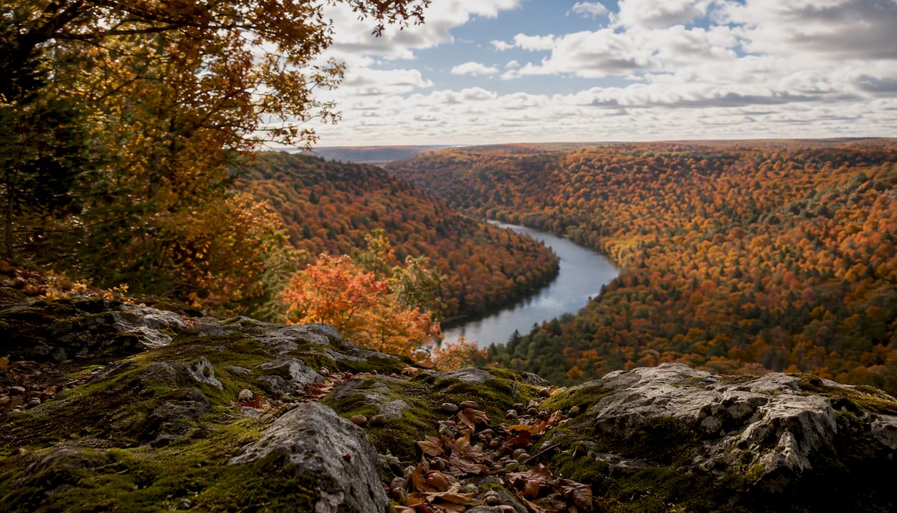
The best fall colours near Toronto: where to go and when
Your top picks for fall colours near Toronto span three tiers: urban and easy (High Park, Toronto Islands, Scarborough Bluffs), escarpment drives about an hour out (Dundas Peak, Rattlesnake Point, Crawford Lake, Forks of the Credit), and longer full-day trips (Niagara Glen, Blue Mountain’s Scenic Caves, Algonquin Provincial Park). Peak colour runs from mid to late September in Algonquin down to mid to late October around the GTA, so your timing depends entirely on which tier you’re chasing.
Here’s the one-line verdict on each, so you can stop scrolling and start planning:
- Dundas Peak / Spencer Gorge — best for the postcard panorama, but you need a reservation.
- Rouge National Urban Park — best for families who want trails without a long drive.
- High Park — best for a short walk with zero planning required.
- Scarborough Bluffs / Bluffer’s Park — best for photographers who want lake and cliff colour together.
- Rattlesnake Point — best for a rugged escarpment hike close to the city.
- Crawford Lake — best for a calm, contained walk with a boardwalk view.
- Forks of the Credit — best for waterfalls plus colour in under an hour’s drive.
- Algonquin Provincial Park — best for the full wilderness experience if you’ve got the whole day.
If you’re short on time, use this quick filter:
- 2 to 3 hours: High Park, Evergreen Brick Works, or Scarborough Bluffs.
- Half a day: Dundas Peak, Crawford Lake, or Rattlesnake Point.
- Full day: Algonquin, Niagara Glen and Niagara-on-the-Lake, or the Scenic Caves at Blue Mountain.
Table of Contents
- When and where leaves peak near Toronto: quick guide
- Best places to see fall colours near Toronto, with logistics
- Sample half-day and full-day itineraries from Toronto
- How to choose the best spot for your trip
- Getting there: transit, driving, permits and parking tips
- Regional timing explained: weather, elevation and colour intensity
- What to bring and basic safety and etiquette for fall outings
- A local guide’s honest take on fall colour trips
- Plan your perfect fall day with Dayhop
- Key takeaways: quick recap
- Sources
When and where leaves peak near Toronto: quick guide
Colour doesn’t arrive on one date across Ontario. It rolls south and downhill over roughly six weeks, and knowing that rhythm is the difference between a spectacular Saturday and a mostly-green disappointment.
- Mid to late September: Algonquin and the Muskoka region start turning first, since higher elevation and more northern latitude cool down sooner.
- Late September to early October: The Niagara Escarpment corridor, including Rattlesnake Point, Crawford Lake, and the Dundas Peak area, hits its stride.
- Early to mid October: Forks of the Credit and the Oak Ridges Moraine around Caledon typically peak.
- Mid to late October: Toronto’s own ravines, High Park, the Islands, and Scarborough Bluffs bring up the rear, since the city’s urban heat island and lakeside microclimate hold onto green longer.
Elevation matters as much as latitude. A lookout 300 metres up on the escarpment can be past peak while a ravine trail at lake level is just getting started, which is why the overall foliage season near Toronto stretches from mid-September to late October depending entirely on where you point the car.
Pro Tip: Weekday mornings, ideally before 9 a.m., are your best window at any popular spot. Lots that fill by 10 a.m. on a Saturday often still have space at 8 a.m. on a Tuesday.
Best places to see fall colours near Toronto, with logistics
Each of these delivers something different, so match the destination to what you actually want out of the day rather than just picking whichever one shows up first on Instagram.
Dundas Peak / Spencer Gorge Conservation Area Best for: the classic panoramic shot over a red and gold valley. Drive time: roughly an hour from downtown. Difficulty: moderate, roughly 1.5 to 2 km round trip with some rock scrambling near the lookout. Transit: not practical, this one’s a car trip. Parking and fees: a timed-entry reservation is mandatory during peak season, with 2-hour or 4-hour slots. Peak timing: late September into early October. The dramatic views and waterfalls at Tew and Webster Falls draw serious crowds, which is exactly why the reservation system exists in the first place.
Rouge National Urban Park Best for: families who want real trails without leaving the city. Drive time: 30 to 45 minutes, or reachable by GO Transit and connecting bus. Difficulty: easy, with multiple trail lengths to choose from. Transit: yes, this is one of the better transit-accessible options. Parking: free at most trailheads. Peak timing: mid to late October. Parks Canada itself recommends visiting between late September and mid-October and suggests weekday mornings and the Central, Harvest, or Northeast Trails for a quieter walk.
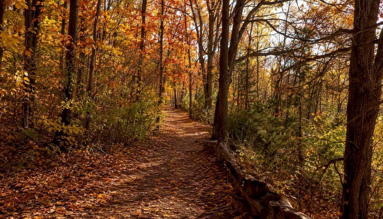
High Park (Toronto) Best for: zero-effort colour on a lunch break or after work. Drive time: around 15 to 25 minutes, or accessible by direct subway stop. Difficulty: easy, flat paved and gravel paths throughout. Transit: excellent, TTC subway drops you right at the park. Parking: limited and paid on busy days. Peak timing: mid to late October, among the last spots in the city to turn.
Scarborough Bluffs / Bluffer’s Park Best for: photographers chasing the contrast of red maples against blue lake and pale cliffs. Drive time: approximately 25 to 35 minutes. Difficulty: easy at the park level, moderate if you walk the bluff-top trails. Transit: TTC bus connections exist but a car is more convenient. Parking: paid lot, fills on weekends. Peak timing: mid to late October.
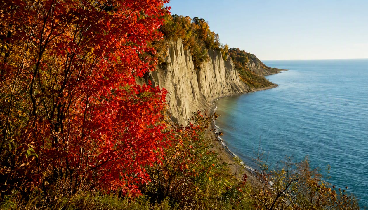
Rattlesnake Point Conservation Area Best for: a proper hike with escarpment drama close to the city. Drive time: roughly 45 minutes. Difficulty: moderate, rocky sections along the Bruce Trail spur. Transit: not realistic. Parking: paid, can fill by mid-morning on weekends. Peak timing: late September to mid-October.
Crawford Lake Conservation Area Best for: a calm, contained walk that still delivers big colour payoff. Drive time: around 50 minutes. Difficulty: easy, boardwalk loop around the lake. Transit: not practical. Parking: paid, reservation recommended on peak weekends. Peak timing: early to mid-October.
Forks of the Credit Provincial Park Best for: waterfalls and escarpment views without the Dundas Peak crowds. Drive time: about 50 minutes from downtown. Difficulty: moderate, with some elevation change on the lookout trails. Transit: not available. Parking: free but limited, arrive early on weekends. Peak timing: mid-October, and weekday mornings genuinely do reduce the crowds here.
Algonquin Provincial Park Best for: the full wilderness fall experience if you can commit the whole day. Drive time: roughly 2 hours 45 minutes via Highway 60. Difficulty: varies wildly, from roadside pullouts to multi-hour hikes. Transit: not available, you need a vehicle. Parking: park permit required at all access points. Peak timing: mid to late September, the earliest of anything on this list.
Niagara Glen Best for: a dramatic gorge-floor trail paired with a Niagara wine country day. Drive time: roughly an hour and a half. Difficulty: moderate to challenging, with steep stairs down into the gorge. Transit: GO Transit reaches Niagara, with local connections from there. Parking: paid lot along the Niagara Parkway. Peak timing: mid to late October.
Evergreen Brick Works Best for: combining fall colour with a farmers’ market and industrial-heritage backdrop. Drive time: around 15 to 20 minutes. Difficulty: easy, ravine trails connect directly to the site. Transit: shuttle bus from Broadview subway station on weekends. Parking: paid, limited. Peak timing: mid to late October.
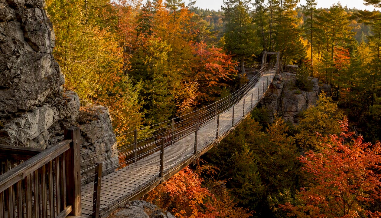
Scenic Caves / Blue Mountain Best for: a full-day adventure combining a suspension bridge, caves, and escarpment panoramas. Drive time: about 2 hours. Difficulty: moderate, boardwalks and cave scrambles. Transit: not practical. Parking: paid on-site. Peak timing: late September to early October, since elevation pushes colour earlier than the GTA.
Sample half-day and full-day itineraries from Toronto
Two quick trips and two longer ones, built so you can leave the house with an actual plan instead of just a destination.
Half-day: urban ravines and islands
- 9 a.m.: Take the ferry to Toronto Islands for open lakeside colour and skyline views.
- 11:30 a.m.: Head back downtown and walk the Don Valley ravine trails near Evergreen Brick Works.
- 1 p.m.: Grab lunch at the Brick Works market before heading home. Contingency: if it’s raining, swap the islands for the covered market and greenhouse at Evergreen instead.
Half-day: Dundas Peak express
- 7:30 a.m.: Leave Toronto to beat weekend crowds, reservation slot booked in advance.
- 8:45 a.m.: Hike to the Dundas Peak lookout, then loop past Webster Falls.
- 11 a.m.: Stop in downtown Dundas for coffee and a bite before the drive back. Contingency: no reservation left? Pivot to Crawford Lake or Rattlesnake Point, both within 15 minutes of the same highway corridor.
Full day: Algonquin loop
- 7 a.m.: Depart Toronto via Highway 400 and Highway 60.
- 10 a.m.: Arrive at the West Gate, pick up your park permit.
- 10:30 a.m. to 3 p.m.: Drive the Highway 60 corridor, stopping at Lookout Trail and Whiskey Rapids for colour at different elevations.
- 3:30 p.m.: Start the drive home before dusk, since Highway 60 has active wildlife crossings at night. Contingency: overcast skies mute colour saturation, so build in flexibility to shift a lookout stop to late afternoon when light softens.
Full day: Niagara Parkway and Niagara-on-the-Lake
- 8 a.m.: Drive or catch GO Transit to Niagara.
- 10:30 a.m.: Walk the Niagara Glen gorge trail.
- 1 p.m.: Lunch in Niagara-on-the-Lake, then stroll the town’s tree-lined streets.
- 3 p.m.: Drive the Niagara Parkway for roadside colour before heading back. Contingency: steep gorge stairs closed for weather? Swap in the flat, paved Niagara River Recreation Trail instead.
How to choose the best spot for your trip
Before you pick a pin on the map, run through a few honest questions.
- How much time do you actually have, start to finish, including the drive?
- Can everyone in your group handle rocky, uneven terrain, or do you need flat paths?
- Are you driving, or would transit genuinely work better for this trip?
- Is the photo you want a wide panorama, a close-up of leaves and water, or people enjoying the day?
Watch for a few red flags before you commit. A reservation requirement, like at Dundas Peak, means spontaneous weekend trips won’t work unless you book days ahead. Steep climbs rule out spots like Rattlesnake Point or Niagara Glen for anyone with mobility concerns. Limited parking with no transit backup, which describes Forks of the Credit and Crawford Lake, means an early departure isn’t optional.
As a quick decision flow: if you have two hours, go to High Park or Evergreen Brick Works. If you want the big panorama and don’t mind booking ahead, go to Dundas Peak. If you’re bringing kids and want trails without a reservation headache, go to Rouge National Urban Park.
Getting there: transit, driving, permits and parking tips
Not every fall foliage spot needs a car, and knowing which ones don’t will save you a parking headache.
GO Transit actively promotes leaf-peeping by train, with routes to Barrie, Burlington, Hamilton, and Niagara offering strong views right from your seat. Pair that with TTC connections and you can reach High Park, Rouge National Urban Park, and Evergreen Brick Works without touching a highway at all. For anywhere on the escarpment, though, from Dundas Peak to Rattlesnake Point to Crawford Lake, you need a vehicle.
- Budget realistic drive times: an hour on paper can become 90 minutes on a fall Saturday.
- Book Dundas Peak reservations online in advance; walk-ups are turned away during peak weeks.
- Algonquin requires a park permit purchased on arrival or in advance through Ontario Parks.
- Free lots at Forks of the Credit and Rouge fill fast; paid lots at Scarborough Bluffs and Crawford Lake are your backup.
- If your first-choice lot is full, have a second spot on the same corridor ready to go rather than waiting it out.
Pro Tip: Weekend parking at Spencer Gorge and Forks of the Credit is routinely full by mid-morning in October. A weekday visit, or arriving right at opening, is the single biggest factor in whether you get in at all.
Regional timing explained: weather, elevation and colour intensity
Colour intensity isn’t random. It’s driven by a specific combination of temperature swings, frost timing, rainfall, and which tree species dominate a given area. Cool nights paired with sunny days trigger the chlorophyll breakdown that reveals the reds and oranges hiding under the green all summer. A late-season warm spell can stall colour, while an early frost can push it fast, sometimes past peak within a week.
Elevation and latitude explain most of the regional spread. Toronto sits at the southern edge of a broader biome transition zone, which means dramatic colour is visible close to the city, but the most intense reds and sharpest contrasts tend to show up a little farther north or higher up, where sugar maples dominate over the more urban-tolerant species found downtown.
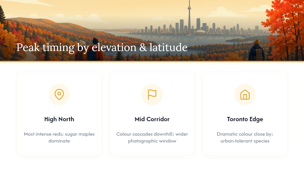
Along Algonquin’s Highway 60 corridor, colour actually cascades downhill, with lower elevations peaking slightly after higher lookouts. That gives photographers a wider window if they plan a multi-stop route rather than banking everything on a single day.
For light, the golden hour just after sunrise or before sunset saturates colour best, especially with the sun low and behind you. A calm, overcast day right after rain can also produce rich, glare-free colour, since wet leaves and diffuse light both boost saturation, but a windy storm will strip a tree bare within days once it’s past peak.
What to bring and basic safety and etiquette for fall outings
Fall days near Toronto swing in temperature more than most people expect, and a solid packing list keeps a good day from turning into a miserable one.
- Layers: a base layer, an insulating mid-layer, and a windproof or waterproof shell.
- Footwear with real grip. Wet, fallen leaves on rock or wooden steps are genuinely slippery.
- Water and a snack, even for a short hike. There’s rarely a store at the trailhead.
- A charged phone, a portable battery, and a paper map or downloaded offline map as backup.
- A small first-aid kit with blister pads, since new hiking boots and long walks don’t always mix.
- Camera gear: a polarizing filter cuts glare on wet leaves and deepens sky colour dramatically.
Cliff-edge lookouts at Scarborough Bluffs, Dundas Peak, and Rattlesnake Point demand real caution, especially with kids or on windy days. Sunset arrives noticeably earlier by mid-October than most people plan for, so build in a buffer before dark, particularly on wooded trails with no lighting. Leave-no-trace etiquette matters here more than ever, since these are some of the most heavily visited natural spaces in the province during a six-week window: stay on marked trails, pack out everything you bring in, and give wildlife space, especially white-tailed deer, which are more active and less cautious during the fall rut.
A local guide’s honest take on fall colour trips
Most fall colour lists near Toronto read like a highlight reel, all panoramic shots and zero mention of the two-hour parking wait that made the day miserable. Here’s what actually matters: the “best” spot changes completely depending on whether you want a quiet morning or a photogenic afternoon.
For a genuinely quiet outing, skip the famous names entirely and drive out on a Tuesday to Crawford Lake or Rouge National Urban Park’s Northeast Trail. You’ll get colour that rivals anything on Instagram with none of the elbow-to-elbow lookout scramble that defines Dundas Peak on a Saturday.
Two route recommendations worth trying: for a car-based day, Forks of the Credit at 7:30 a.m. followed by a lazy lunch in nearby Terra Cotta beats fighting Dundas Peak traffic for a similar payoff. For a transit-based day, ride GO Transit toward Niagara and get off the train itself for views that rival the destination, then walk Niagara Glen once you arrive.
The honest trade-off is this: panoramic hotspots like Dundas Peak deliver the single best photo, but they cost you time, a reservation, and patience. Quiet city ravines deliver 80 percent of the visual payoff for a tenth of the hassle, and most people underrate that trade until they’ve sat in a gravel lot for 40 minutes waiting for a parking spot that never opens up.
Plan your perfect fall day with Dayhop
Dayhop is the shortcut for anyone who wants a fall colour outing planned in minutes instead of an evening spent cross-referencing drive times, reservation pages, and weather forecasts. Tell it how much time you’ve got, whether you’re driving or taking transit, and who’s coming along, and it builds a day around that, matching trail difficulty and distance to your actual constraints instead of a generic top-ten list.

Where Dayhop actually saves time is in the boring parts: it flags when a spot like Dundas Peak needs a reservation, suggests a nearby backup if a lot’s likely to be full, and slots in a lunch stop so you’re not scrambling to find food mid-hike. It adjusts in real time too, so if the forecast shifts, your plan shifts with it instead of leaving you stuck with a rained-out itinerary. Head to the Dayhop day-planning platform and build your fall day around exactly the amount of time, walking, and travel you want. This section is a promotional feature for Dayhop’s own platform.
Key takeaways: quick recap
The best fall colours near Toronto reward planning around distance and timing together, since the closer you stay to the city, the later in October you should go.
| Point | Details |
|---|---|
| Match distance to time | Pick urban spots for 2 to 3 hours, escarpment drives for a half day, and Algonquin for a full day. |
| Book ahead where required | Dundas Peak needs a timed reservation during peak weeks; walk-ups get turned away. |
| Go early on weekdays | Weekend lots at Forks of the Credit and Spencer Gorge often fill by mid-morning. |
| Pack for temperature swings | Layers, grippy footwear, and a charged phone matter more than fancy gear. |
| Let Dayhop handle logistics | Dayhop builds a tailored day plan around your time, transit needs, and group, including reservation flags. |
Sources
Before you commit to a long drive, confirm conditions directly from the source rather than relying on a list written weeks earlier.
- Fall Colours at Rouge National Urban Park - Rouge National Urban Park
- Spencer Gorge Conservation Area reservations
- Fall for the foliage this autumn with GO Transit
- Ontarioparks
- Plan a day trip: Forks of the Credit — Ontario Parks blog
Check reservation pages before you leave the house, and check colour reports the morning of, since a warm week can shift peak timing by several days in either direction.
Fall colours near Toronto are worth planning around timing and distance together, not just picking whichever trailhead photo looks best online.
Recommended
Plan my day →